Sandy anniversary media roundup, and Secret Science Club

Yesterday was the two-year anniversary of the landfall of Post-Tropical Storm Sandy. The occasion was marked by a brief spate of Sandy-themed media stories. I was part of a few of those, so the book got some attention. In the midst of this self-promotion, I did my best to take a few moments to remember the disaster itself and those who suffered grievous losses because of it.

But, ok, here is an account of the various media and things. The Sandy anniversary wasn’t about me, but this blog kind of is, right?

Most prominently, I had the opportunity to be a guest on the Leonard Lopate Show on WNYC. The podcast is here – it’s around 40 minutes long!

Then, one thing that was not media per se, but a live event featuring an actual audience: on the evening of Tuesday October 28 I had the pleasure of giving a talk for the Secret Science Club, at the Bell House in Gowanus, Brooklyn. (Here is a detailed account of my talk by an audience member, whom I didn’t have the pleasure to meet.) I had done this once before, just a couple of weeks after Sandy.

If I had not been to these events, I wouldn’t have believed that they could exist. A scientist gives a talk in what is basically a rock club. The space holds a few hundred people, and it pretty much fills. The crowd is incredibly enthusiastic, and asks questions afterwards for as long as time permits – the organizers, Margaret Mittelbach and Dorian Devins, have to shut the Q&A down after a while. What is most remarkable about this is that most of the scientists who speak are not celebrities. I, for example, am no Neil DeGrasse Tyson. Yet several hundred people turn up, regularly, to hear what are – at least in my case – nothing more than power point science talks.

In the routine activities of scientists, we never have this experience. I have given many, many talks, but have never  had the kind of reaction that I got from these audiences. No matter how good a talk one gives to a room full of scientists, they never get that excited. They have heard many, many talks, and are jaded. It’s a newer experience for these people who come to SSC, I guess. In any case they are definitely not jaded, but respond as though they were at a theatrical performance. Or a comedy show. I have never had so many people laugh at my jokes.

What the SSC made me think the first time, and still does, is: if this can be a thing, can it be ten things? If you can fill a big performance space once or twice a month with people listening to science talks, could you fill many more, many more often? Could we have as many evening venues for science as we have for comedy, theatre, or music?

Anyway, then here are a few online articles in which I was quoted in the last couple days (in some of them at great length):

Climate Central story on how Sandy has inspired new research in the last two years.

Vice News story on New York City real estate and FEMA flood zones.

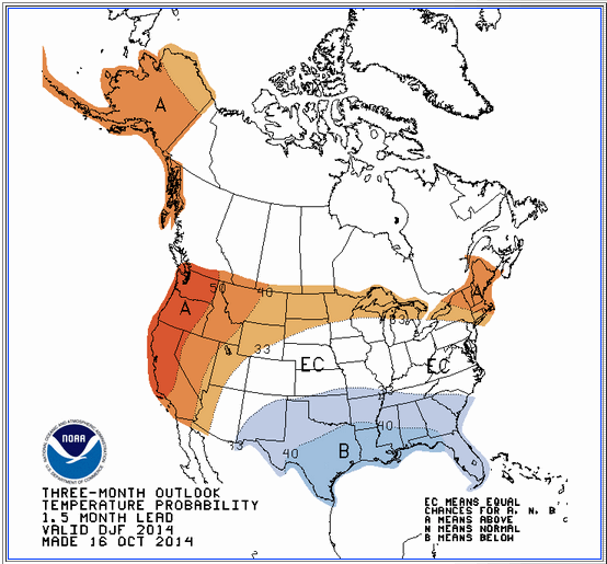
Salon story (via alternet) that’s not about Sandy at all, but about the seasonal forecasts for next winter; this is the one that led to my blog post last week.

New Jersey Star Ledger opinion piece by Paul Mulshine based in large part on a phone interview with me.

On seasonal forecasts for this winter

I was contacted by a reporter to comment on the apparently radical difference between different seasonal forecasts that are currently available for the upcoming winter here in the northeast. The private company AccuWeather predicts a cold winter for us, while the Climate Prediction Center, a US government facility under the National Oceanic and Atmospheric Administration (NOAA) predicts that a warm winter is more likely. This post is an expanded version of the comments I wrote to him by email.

Here is the map showing the current AccuWeather forecast for this winter.

accu

The map is accompanied by an article stating the forecast in words. It begins: “Though parts of the Northeast and mid-Atlantic had a gradual introduction to fall, winter will arrive without delay. Cold air and high snow amounts will define the season.” Those are confident statements, with no expression of uncertainty. The rest of the article is the same.

Here is a salon.com story based on the AccuWeather forecast.  The headline is “Bad news, America: The Polar Vortex is coming back!”

Here is a map showing NOAA’s temperature forecast  for December through February in graphic form. (Original link here).

noaa_map

It shows warm for the northeast, where AccuWeather showed cold. But I am not really interested in that difference. The more important difference is that NOAA’s map shows probabilities.

The NOAA map states the forecast in terms of the probability that the temperature will be normal, above normal, or below normal. These are defined as terciles, or ranges capturing 1/3 of the historical data – 1/3 of all winters have been in each range. Thus if we had no other information (no current weather data, no forecast models, etc.), we would say there are equal chances of above normal, normal, or below normal – the chance for each would be 33%. Areas where this is the case in NOAA’s judgment are shown as white on the map. Red means the chance of above normal is significantly greater than that for below normal, blue means vice versa. The probabilities for either above or below are nowhere much greater than about 50%, meaning that even where it’s red, for example – meaning warm is more likely – there is still a significant chance of cold. In other words, the forecast is uncertain.

Here is a USA Today article with some statements from NOAA CPC Acting Director Mike Halpert, expressing that uncertainty in words.

The current state of the science is such that seasonal forecasts such as these have only a modest amount of skill, even in the parts of the world where they are the best. That means if you were to bet on them every season for many years, you would make money in the net, but not a lot. The tercile probabilities, with their modest departures from 33%, communicate that.

Further, the eastern US is an area where the forecasts are particularly unskillful. (The west coast, for example, is more strongly influenced by El Nino events such as the one that is trying to get going now, and more predictable as a result of that.)

So a confident forecast that a cold winter (or a warm one) will occur, with no statement of uncertainty or probabilities – such as AccuWeather’s – gives an exaggerated and misleading impression of the degree of certainty that is possible.

The NOAA forecast is truer to the science, in that it is stated in terms of probabilities, and does not express a high degree of confidence in any one outcome. That  doesn’t mean it won’t be a cold winter, as AccuWeather says; it might be. It just means there is no way of being anywhere near as certain as their forecast implies.

That said, AccuWeather may be taking their cue from our normal daily weather forecasts (including those from NOAA, of which the National Weather Service is a part). Those too, really, should also be stated in terms of probabilities, but are not. (Actually, they are, for precipitation, e.g., 50% chance of rain, but not for temperature.) So perhaps AccuWeather thinks people are more comfortable with deterministic forecasts, and thus choose to provide deterministic seasonal forecasts as well, even though they know (I have to assume they know) they will be wrong a good fraction of the time. I think that is unwise, given the low skill of seasonal forecasts in particular; it gives the public the wrong idea about the nature of the information they are being given. I believe most people are capable of understanding basic probabilities, and would be better served by forecasts stated in those terms.

I have not addressed why AccuWeather is going cold for the northeast while NOAA is going warm. I don’t know the answer to that. I am pretty sure they have access to most or all of the same information and just interpret it differently. But in my view it would be misleading to focus on this difference. The more important point is that both forecasts are uncertain, and should rightly be expressed in terms of slight changes in the probabilities. NOAA does express it this way, while AccuWeather doesn’t.

Finally: without looking at any weather data or models, one can say pretty confidently that it is very unlikely that this winter will be as cold as last winter was in the eastern US. Last winter was very extreme by historical standards, so a winter that extreme is – basically by definition – improbable in *any* year. No information currently available (including the state of El Nino), or that will be available ahead of time, is strong enough to change that. Again this is a probabilistic statement: it’s not impossible that this winter will be as cold or colder than last, it’s just very unlikely.

Climate Services: Two conferences on two continents

I spent this past week in Darmstadt, Germany, for the Climate Symposium. This was a conference organized by EUMETSAT (one of the European space agencies) and the World Climate Research Program.

The conference had a couple of goals. Perhaps most prominent was to “ascertain critical objectives to be achieved with satellite-based climate information, and identify gaps in the current space-based component of the climate observing system” – in other words, help EUMETSAT decide what new satellite instruments to build and launch in the coming years. The idea here was to present the current state and future needs of climate science in order to determine how new satellite observations could help. The climate science was presented through the lens of WCRP’s new Grand Challenges. (I am involved directly in one of these, on Clouds, Circulation and Climate Sensitivity, and interacting with the leaders of another, on Understanding and Predicting Weather and Climate Extremes.)

Climate science justifies its funding largely on the basis of its benefit (real or potential) to society, and that justification was particularly explicit at this conference. A lot of the program was devoted to “Climate Services”. This term refers to entities and people whose jobs lie in between the physical science of climate and “users” of climate information, also known as “stakeholders”. Climate Services involves translating the information that climate science can provide into terms that will be most useful for specific human purposes. (In the US, NOAA tried a few years ago – at the instruction of President Obama – to create a National Climate Service, with a status analogous to the National Weather Service. Congress, much of which hates even the word “climate”, killed it.) In practice, Climate Services is about taking the time to learn what specific users’ needs are, teaching those users what climate information current science can and can’t provide, and packaging the information to make it easier for them to digest.

Most of what I know about Climate Services comes from the International Research Institute for Climate and Society (IRI) at Columbia, which has been providing climate services since well before I (or most other people) ever heard the term. I was initially hired at Columbia through the IRI, which came into being a couple of years before I arrived here in January 2000. The IRI, in turn, exists because of the work of Mark Cane.

In the 1980s, Mark and his then student Steve Zebiak (later to become a founding member, and then director of IRI) developed the first numerical model that was capable of predicting the El Niño/Southern Oscillation (ENSO) phenomenon. They demonstrated this by making a successful prediction of the 1986/87 event.

While ENSO occurs in the equatorial Pacific, it has influences on climate and weather across much of the earth. An El Niño, for example, typically causes drought in Australia, Indonesia, southern Africa, and northeast Brazil, wet weather in southern California and unusually clear weather in the Pacific Northwest, and fewer hurricanes in the Atlantic, among other changes. Cane and Zebiak realized that the forecast capability they had developed had the potential to make a positive difference to the lives of a substantial fraction of the planet’s population. By knowing something about how the upcoming season or two would be likely to differ from the usual, people and governments could plan ahead across many sectors of activity: agriculture, water, health.

The IRI was created to realize that potential, and has been working with countries around the world for over 15 years to that end. While the notion of Climate Services now is as much about long-term anthropogenic climate change as it is about interannual variability (a la ENSO), ENSO and the IRI were at the start of it as much as anything, and are still a critically important component.

Tomorrow – Monday October 20 – we will start The Tropics Rule, a Symposium Honoring Mark Cane’s Contribution to Climate Science. This will be a two-day event on the occasion of Mark’s 70th birthday, featuring a long list of distinguished scientists presenting new research and historical reflections on Mark’s long career of truly amazing scientific achievements. It will take place in Monell Auditorium, the physical home of the IRI, on the Lamont Campus.

So in summary, I got on a plane to fly to Germany for a conference where I heard about the present and future of Climate Services. Then I got back on a plane to fly home to attend another conference at my own institution, in honor of the scientist who, it is not a great exaggeration to say, invented the idea.

Book things

Storm Surge got a nice review in Publishers Weekly. Here it is quoted in its entirety:

“Hurricane Sandy hit metropolitan New York hard in October 2012, knocking out power while ruining homes and businesses; it turned parts of Manhattan into swampland, flooded subway stations and transit tunnels, and devastated much of the Jersey shore. Though the damage it caused is irrefutable, the cause of the hurricane itself, says Columbia University atmospheric scientist Sobel, is up for debate. In this comprehensive volume, he looks at the science behind Sandy (and similar weather systems), examining the circumstances leading to it—”the left turn it took” in the ocean in “a radical departure from all known meteorological history”—and factors that made it a superstorm. How did it complete “its transition from a tropical cyclone to a mammoth hybrid”? Sobel diligently re-creates a timeline, from the early warnings issued by the National Hurricane Center to government evacuation orders to the impact Sandy had once it made landfall. Along the way, he provides substantial background information on what, exactly, a hurricane is and how the Fujiwhara effect—named for Japanese meteorologist Sakuhei Fujiwhara—applies to dueling vortices. Topics like these make for interesting, if technical, reading, and Sobel manages to strike an effective balance. (Oct.)”

And, Kevin Krajick has posted an interview piece with me on the Columbia Earth Institute State of the Planet blog.

Hudhud at landfall

2014IO03_4KMIRIMG_201410120100

So while Vongfong was the big weather story a few days ago – when it reached intensities close to Haiyan’s last year – it is now down to low category 1 intensity, and forecast to weaken further before reaching Japan.

In the meantime, a new tropical cyclone has formed in the Bay of Bengal, strengthened dramatically, and is now in the process of making landfall in Visakhapatnam, Andhra Pradesh, on the east coast of India. The peak winds are estimated by JTWC at 110 knots, a high category 3, nearly category 4 cyclone. This has the potential to cause great destruction. The image at top shows the most recent enhanced infrared satellite image of Hudhud, taken from CIRA.

Here is a recent story in the Guardian reporting that “hundreds of thousands” of people are being evacuated, and a story in Slate by Eric Holthaus. As Holthaus notes briefly in his story (and more on twitter) the India Meteorological Department has estimated Hudhud’s intensity at much lower values than other agencies have; IMD currently is calling Hudhud a 90-knot storm as opposed to JTWC’s 110). But the mass evacuations attest to the seriousness of the Indian government about this storm. Cyclone Phailin, last year, was similarly powerful, and also was the subject of dispute between IMD and foreign meteorologists, with the IMD calling the intensity lower in that case as well. The preparations and evacuations for Phailin were remarkably successful, keeping the death toll very low by historical standards. Hopefully the same will be true this time.

Here’s a surge and inundation forecast from IMD, predicting peak values in the 2 meter range for Visakhapatnam.

surge_imd

Riskies

I spent yesterday at the Northeast Risk & Resilience Leadership Forum, in the Marriott Hotel in Stamford, CT. This is an event put on by the Risk Sciences Foundation, which is connected to the reinsurance company Renaissance Re. It was a one-day meeting on the risks faced by the northeast US coasts due to storms, sea level rise, and climate change: what the risks are, and what governments, private companies, and anyone else might do about them. With its two-year anniversary coming up, Sandy loomed large.

This meeting was different than my usual. I go mainly to scientific conferences, where the speakers are mostly other research scientists and everyone talks about scientific research. There are sometimes a few people with a policy bent, but they’re a minority, and they don’t change the dynamic much; they come to keep up with the science.

The crowd at this meeting was more eclectic. One wouldn’t necessarily think of the different groups who showed up as being similar, but they share an interest in the theme of coastal risk. Beyond that, they share a set of concepts and understandings about what could be done better.

Of course you had your insurance and reinsurance people; they organized the meeting. Then there were people whose jobs are about making housing more disaster-resistant, through building codes and the like (Federal Alliance for Safe Homes, Insurance Institute for Business and Home Safety). This group is connected with the insurance industry but doesn’t actually sell insurance. There were people from government agencies – federal (including one U.S. senator and one Obama administration official), state, and local; some had titles that wouldn’t have existed too many years ago (e.g., “Chief of Environment, Energy and Open Space” or “Senior Policy Advisor, Climate Change and Insurance”). Then you had various nonprofits of a more or less environmental bent (National Wildlife Federation, Union of Concerned Scientists). And finally, a few academic scientists.

All these people agree that we don’t take the risks from coastal storms seriously enough, and that more money and effort should be put into pre-disaster “resilience” (ultra-trending buzzword of the moment) rather than just post-disaster recovery.

There are differences of emphasis in how the different constituencies would do this. The nonprofit types advocate for green infrastructure, ecosystem restoration, and sustainable development – including slowing or even reversing development in the most vulnerable coastal areas. Insurance people (and ok, a lot of others) advocate for reform of the National Flood Insurance Program to make it solvent – exactly as the Biggert-Waters act did, before it was substantially rolled back – and thus to de-incentivize development in those risky areas by raising rates there. Housing people advocate for better housing.

There was no contentious argument about which of these was more important. Rather, there seemed to be consensus that all of them are good, all are complementary, and none are being done enough now.

The scientists, like me, just advocate that everyone should pay attention to the science. (I argued that sea level rise is the most important factor increasing risk, at least as far as we can say now with certainty; changes in storms may well be important too, but are more uncertain and will take longer to show up above natural variability). That wasn’t a hard sell here; if there were any climate change deniers in the house, they stayed silent.

The fact that this was true at a meeting organized by a reinsurance company is big by itself. The insurance industry is not Greenpeace or 350.org; they take climate change seriously for purely business reasons. Given the way the political discussion around climate is often cas in this country, insurance (or reinsurance) companies do us all a service by talking about it publicly. (The US military is perhaps the other organization that takes climate change most seriously while conforming least to any stereotype that one might associate with that stance. There were no military at this conference to my knowledge, but there was Alice C. Hill, high up in Obama’s Homeland Security team. She said “Climate change is a threat multiplier.”)

While a lot of interesting people said a lot of interesting things, I was mainly impressed just by how well this diverse group hung together. There should be a name for this collection of people that captures their shared interest and purpose. I hereby propose “riskies”.

Rapid intensification – Vongfong update

This is the down side of trying to blog an extreme weather event in real time while holding down a full time job as an academic. Just can’t keep up.

2014WP19_1KMSRVIS_201410070801

When I wrote my previous post on Typhoon Vongfong (shown above in a recent visible satellite closeup, from this great site) last night, Vongfong’s winds were estimated at 90 knots, and the Joint Typhoon Warning Center (JTWC) had forecast that it would intensify to 130 knots over the next 48 hours. When I woke up this morning it was estimated at 120 knots already; it’s now at a screaming 155 knots, or 178 mph (per JTWC).

The NHC defines “rapid intensification” as an increase of 30 kt in 24 hours, so Vongfong has definitely undergone rapid intensification. It was not forecast, but it rarely is. While tropical cyclone track forecasts have improved steadily for decades, intensity forecasts haven’t, and the difficulty of forecasting jumps like Vongfong just made are a big part of the reason.

It’s not just the forecast of the storm’s future that’s the issue, though. Even estimating its intensity at the present moment poses challenges. While JTWC is calling it 155 knots – the very upper end of category 4, pushing category 5, the top of the scale – the most recent estimate from the Japan Meteorological Agency (JMA) puts it just at 115 knots, low category 3. Some of this difference is attributable to the different standards; JTWC uses 1-minute averaged sustained winds while JMA uses a 10-minute average, which tends to be a little lower. But that isn’t the whole story.

In fact, no one is measuring the winds in Vongfong. There is no routine aircraft reconnaissance in the Western Pacific to make direct observations. The estimates all come from analysis of satellite observations, and satellites don’t measure the winds directly. The satellite images used to estimate intensity see some combination of clouds and water vapor, and either human analysts or automated pattern recognition algorithms use those to infer the wind speed. (To get some idea how it’s done, try this.)

There’s no doubt that Vongfong is a very powerful storm. The forecast models are mostly predicting that it will start to weaken by a day or so from now, perhaps after holding steady or even intensifying a bit more before then (see for example a collection of current forecasts on Kerry Emanuel’s page). The track forecasts are still taking it over Japan early next week. Assuming that pans out, as seems likely, the question is just how rapidly Vongfong loses its currently formidable head of steam.

Vongfong – like mother like daughter?

Fortunately, Phanfone turned out not to be a major disaster for Japan. There have been some power outages, some disruption to air travel and other things, and a handful of people killed (mainly due to being in or near the waves at at a bad time, whether the Americans in Okinawa or the surfer in Kanagawa). Nothing to make light of, but not nearly as bad as it could have been.

But it’s not yet time for Japan to relax. The next Typhoon, Vongfong, is spinning its wheels in the tropical western Pacific, and is likely to take almost the same path as Phanfone did, down to the landfall on Honshu, Japan’s big island.

Vongfong is currently estimated to be a category 2 storm, with peak winds of 90 knots, or over 100 mph. It has developed the appearance to go with that intensity, including a proper eye, seen here in the latest visible satellite image:

mtsat


Track and intensity forecasts for this storm, as for all tropical cyclones in the western Pacific, are issued by the Japan Meteorological Agency (JMA) and the US Joint Typhoon Warning Center. Like the US National Hurricane Center (which produces all our forecasts here in the US for the Atlantic and Eastern Pacific) and other forecast centers worldwide, both agencies issue forecasts out to 5 days. The current track forecasts look quite similar to what Phanfone’s did at this stage. This includes especially the northward turn, scheduled for around 48 hours from now, shown here in the current forecast map from JMA:

JMA

While these forecasts have no landfall in them yet, the numerical models seem to be reaching some agreement that Japan is likely to get another one in about a week. Here is a forecast map from NOAA’s GFS model for 00 UTC next Tuesday, October 14. (The recent runs of the ECMWF model look pretty similar.) The map shows surface pressure (contours) together with 500 hPa geopotential height (color shading). Vongfong is the bullseye riding up the east coast of Honshu, interacting with an upper level trough (the southward dip in the ribbons of color) to undergo extratropical transition into a midlatitude cyclone:

GFS


Even the intensity forecast (from JTWC) is eerily similar to Phanfone’s. At 90 kt now, Vongfong is forecast to make it up to a 130 kt super typhoon, in the low end of category 4, over the next 48 hours, before starting to weaken again as it moves over cooler waters and higher wind shear. Just how much it weakens is the key question – the phasing with the upper trough in the model run above is just of the right kind to add an extra jolt of energy from the jet stream at landfall. (That’s what happened to Sandy just about two years ago, and in fact the map above would look quite similar to the equivalent one at Sandy’s landfall, if one were to swap North America for Asia.)

Why would two storms develop so similarly, one right after the other?

First, the Western North Pacific has more tropical cyclones per year than any other region on earth. A typical year sees around 90 in the whole earth; the WNP typically accounts for 25 or 30 of those. For our North Atlantic 10 would be about average.

But there’s more to it than just a lot of storms. They do form in bunches sometimes, and it may not be an accident. One typhoon can help generate the next one, when its own spin interacts with the earth’s much larger-scale rotation to produce a “Rossby wave” wake in the atmosphere to its east or southeast – a high pressure, clear weather ridge, followed by another low-pressure trough, typically about 2000-3000 km away, which then is a promising site for another typhoon to form. I haven’t analyzed the early biographies of Phanfone and Vongfong yet to see if they might have been such a “mother-daughter” pair at Vongfong’s genesis, but if they did it wouldn’t be very unusual.

As for the tracks being the same after genesis, that may be just a consequence of the large-scale steering winds not having changed much during the interval between the two storms. It’s fall, the Pacific jet stream should be starting to make its way south, but isn’t far enough south yet for its westerlies to blow the storms back out to sea before they get as far north as Japan.

While those scientific explanations are backed by some research – the links above are to my own research papers, with my former Ph.D. student Kyle Krouse – I don’t think we understand everything we could about the clustering of tropical cyclones in time and space.

Perhaps the most extreme case in (relatively) recent memory was the Atlantic season of 2005, when the hurricanes just kept coming, one after another, long after they had any right to. That was mind-boggling at the time. This current pair in the Pacific may be less so, but it still feels a little spooky.

Typhoon Phanfone – a post that will be immediately out of date

Typhoon Phanfone has been closing in on Japan for days, and is in the process of making landfall as I write.

The storm earlier had made it to the bottom end of category four on the Saffir-Simpson scale, with peak sustained winds of 130 knots and a very small “pinhole” eye. The pinhole eye is almost always a sign of a scary storm, because the way tropical cyclones develop really strong winds is by contracting their eyewalls inward. As with a skater who pulls her arms in while she does a spin on the ice, conservation of angular momentum increases the rate of rotation because the distance from the axis has shrunk.

By now the storm is considerably weaker, with peak sustained winds estimated at 80 knots, category 1. According to the cyclone phase space diagnostic of Prof. Robert Hart at Florida State University, Phanfone is in the process of extratropical transition, turning into an extratropical or “winter” type storm. It has lost its eye and most of its circular symmetry, as one can see in the current infrared satellite image, and is forecast soon to lose its warm core. In a current weather map with colors showing temperature at 850 hPa (about 1.5 km above the surface; this is actually a plot from the most recent 12-hour forecast made by NOAA’s GFS model about 12 hours ago, image courtesy weather.unisys.com), one can see the strong contrasts associated with fronts, typical of extratropical storms, cutting through the center. The strongest rains will be on the left side of the track – over land – as the moist tropical air rides counterclockwise up and over the colder air mass to the west.

phanfone


Despite its weakened status, Phanfone is still no joke. The rains will likely be in the hundreds of mm (100 mm = about 4 inches), including likely on Mount Ontake, the volcano where over 50 people died in the recent eruption and the recovery of bodies is still ongoing.

The storm surge forecasts appear to be in the 1-2 meter range, or 3-6 feet. The warnings appear to be concentrated in Fukushima prefecture, site of the 2011 tsunami-induced nuclear disaster. While storm surges and tsunamis have completely different causes, they are otherwise very similar phenomena – either way something pushes the sea onto the land. The 1 or 2 meters this typhoon is forecast to produce are nothing compared to the 40 meters that the earthquake of three and a half years ago produced, so that’s good. But still… I have no detailed knowledge of the current state of the Fukushima Daiichi nuclear complex, but my understanding is that it is still not in particularly great shape. I hope that 1-2 meters of surge plus combined heavy rains and wind aren’t enough to do any more serious harm to this already awfully blighted place.

In news coming in now: images of flooding, and speculation that Tokyo, almost directly in the path of the center, might see an all-time record for strongest wind.